King Tides
Yesterday
and today were the highest tides of the year – 7.1 ft at 9:20 am on Wednesday
and 7.2 ft today at 10:09. I traveled to Bolinas and Stinson Wednesday with my
camera and to collect water samples for Surfrider’s water testing program. The
water was rushing up the ramp at the end of Brighton Avenue and the waves were
crashing against the retaining walls of the houses on both sides. The water was
so high that there were no waves breaking at the Patch. The water rose four to
five feet (my guess) up the cliff causing the swells to merely surge against
the cliff wall. At the Groin, the entire Groin wall, from the cliff to the
Groin pole, was inundated, the swells reached half way up the pole and the
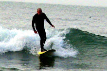
waves broke inside the point of the cliff. It was not a good surfing day.
Last
September at the Surfrider Foundation Conference, which I attended, I heard the
term “King Tides” for the first time. It came up in the sea level rise
discussion. The speaker (sorry I can’t remember his name) mentioned the King
Tide Photo Initiative. King Tides are the highest tides of the year, and they
occur when the sun and the moon are aligned with the earth for maximum gravitational
pull. Alignment occurs in during summer and winter months, and for a few days
(four or five) the tides are extremely high and of course extremely low. He
stressed that the King Tides illustrate those points along the coast that will
be most impacted by sea level rise. The Tide King Photo Initiative encourages
people to photograph flooded areas during extreme high tides, post them online
to educate and alert people about potential problem areas.
So
I have taken up this cause. I photographed Bolinas and the Bolinas Lagoon
yesterday and low areas of Mill Valley today – mainly Tam Junction and the
wetlands along the edge of Richardson Bay – and have posted them online, 41
photos in all. Click on the link below to view them. Here’s a list of what I
saw:
- Bay Front Park, Mill Valley,
in front of the Southern Marin Sewage Plant – the bike trail was
inundated.
- In Bolinas, the boat ramp at
the end of Brighton Avenue was swamped, waves crashed against the two
houses at the base of the ramp and Groin wall was under water.
- Highway 1 around the Bolinas
Lagoon, at several points the water level of the lagoon was up to the edge
of the road.
- Seadrift, the water level of
the lagoon reached the backyards of houses situated on the lagoon side.
- In Mill Valley, police
closed the northbound direction of Miller Avenue at Almonte, which is the
south end of Tamalpais High School.
- The water level of Richard’s
Bay covered all of the wetlands, flooded parts of the bike trail and
reached of bottom brace of two bike path bridges.
- The high tide flooded the
parking lot of the motel next to the bike trail.
- The Highway Patrol closed
the Manzanita Park and Ride due to flooding of the entrance and the access
road.
- Water flooded a hundred
yards of the bike trail near the Richardson Bridge.
All
you surf photographers get ready, the next King Tides are coming in a couple of
weeks – 7.1 ft high tides Thursday and Friday, January 10 and 11. Let’s start
building a photo journal of vulnerable sea level rise areas in Marin. Meanwhile
check out my King Tides photos.